Alaska’s Best Road-Accessible Hikes
I hiked the best road-accessible hikes in Alaska in July 2014. Here’s everything you need to know. I’ve aimed to simplify your choices instead of being exhaustive.
Harding Ice Field, Kenai Fjords National Park, Seward
 Elevation gain: 4000 feet
Roundtrip: 8.2 miles / 7 hours
Hiked on: July 2014
This hike parallels the Exit Glacier in the Kenai Fjords national park, with spectacular views of the valley. It ends with the jaw-dropping sight of the Harding ice-field. The trailhead is a few hours drive south of Anchorage.Take the highway to Seward. Just short of Seward, turn right on to the road to Exit Glacier. Follow signs and park at Exit Glacier. Hop into the visitor center for last minute information and then head up the trail.
This trail is steep! About 4000 feet in 4 miles. It’s a great workout. About halfway, the views open up. We hiked this on the most beautiful summer day imaginable. 2 miles in, the jungle gives way to meadows of alpine wildflowers. You have to pinch yourself. The beauty is absurd. You hike on and rise higher and higher, paralleling the glacier. The wildflowers give way to snowbanks. A few snow banks and you round a bend to be faced with the Harding ice-field. A sea of white stretching to the horizon; all sense of depth-perception lost. Solitary nunatuks hem the horizon, the ice glistening in the summer Sun. This hike is like Antarctica on one side and gorgeous alpine meadows on the other.
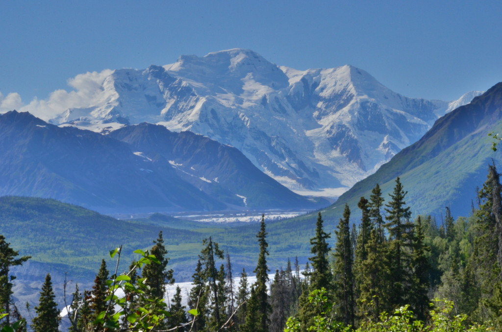
Kesugi Ridge Trail, Denali State Park

We, dwarfed into insignificance, ponder Denali.
Note: The Kesugi ridge trail is a one-way backpacking trail.
One-way: 27 miles, 2-3 days.
Elevation gain: 5000 feet total (very rough est.)
Hiked on: July 2014.
Why Kesugi Ridge?
Does the Denali national park’s bureaucracy and lack of trails frighten you? Do you have absolutely no clue which units you should select? Or, how on Earth are you supposed to prepare to backpack in the Alaskan wilderness? Guess what, we neither! Instead, we choose the Denali state park over the Denali national park. The Denali state park has zero bureaucracy. But, it boasts a gorgeous 27-mile long hiking trail with convenient start, end, and mid-points. On a clear day, you have stunning front-line views of Mt. Denali.
How to hike it?
Familiarize yourself with the location of the state park and of the trail with the trail map. Typically, you park at one end of the trail, hitch a ride down the Denali highway to the other end, and hike back. It can take an hour or more to find a ride because traffic is sparse and drivers rarely stop. There is also a shuttle. We hiked north to south because the elevation gain is less (I think). But more importantly, the northern half is far easier to traverse. In summer, the southern half can be painful mulch jungle. And, heaven forbids it pours, you’re in for it. Your ace-in-the-hole is that you can exit at the Ermine Hill trail. Indeed, I would go as far as to recommend you park at Ermine Hill, hitchhike or walk to Little Coal Creek trailhead, and hike back. But, nothing wrong with hiking from Little Coal to Byers Lake as long as you’re prepared.
What was your experience?
We started from Little Coal. The initial elevation gain is about 2000+ feet. You hit the ridge soon. Mt. Denali is typically obscured by clouds but the views are gorgeous nonetheless. It was a little cold. We were overly concerned about bears/marmots. When we camped the first night, we took great pains to dig a hole, put our food in, and cover it. But we didn’t see any. The next day I’d seen what I had to, and I split at the Ermine trail to get back to the highway. It turned out to be a great decision. Apparently the trail simply deteriorates there-on and Evan and Jesus had great trouble getting through the slush and jungle. Evan’s feet were blistered the next two days from water soaking through her shoes. Note, the Ermine hill trail splits off after the lake. There is a short false trail before the lake that I got lost on. Bonus: I ran into a bear while lost and scared it!
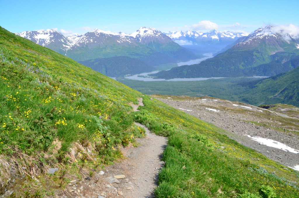
Worthington Glacier ridge hike, Worthington Glacier state park, Valdez.
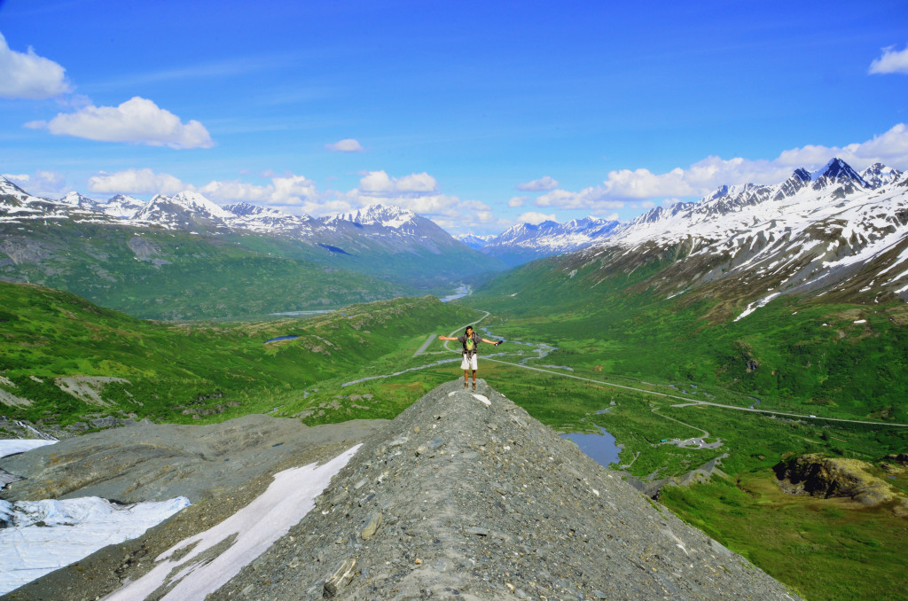
Worthington Glacier ridge hike, Valdez, Alaska.
Elevation gain: 1500 feet est.
Roundtrip: 3 miles / 3 hours
Hiked on: July 2014
This hike is so absurdly spectacular in good weather, that I dedicated a separate post to it. Read here: www.karangill.com/worthington-glacier-ridge-hike-great-alaskan-hike/.
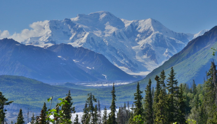
Bonanza Mine hike, Wrangell – St. Elias national park, Kennecott.
Mt. Blackburn, Wrangell-St. Elias national park, Alaska.
Elevation gain: 3800 feet
Roadtrip: 9 miles / 7 hours
Hiked on: July 2014
This was the hike we choose in Wrangell-St. Elias and we were not disappointed! When you reach the ridge above the mine, you horizon is a ring of jagged, snow-capped mountain peaks. You can see 5000 meter high Mt. Blackburn with Root Glacier streaming below it, and massive high mountains into Canada on the other side. It’s just great.
The trailhead is at the Kenecott historic mill town. You cannot drive there. Instead, you can only drive to McCarthy. From McCarthy you must walk across the bridge and take the shuttle to Kenecott. It’s best you call the park for the latest shuttle timings and plan ahead. Note that if you finish the hike early then you can take crampons and hike on Root glacier too! The Bonanza mine trail is your standard tiring but rewarding day hike; nothing you can’t handle!
Matanushka Glacier hiking, Hwy 1 about 50 miles east of Palmer
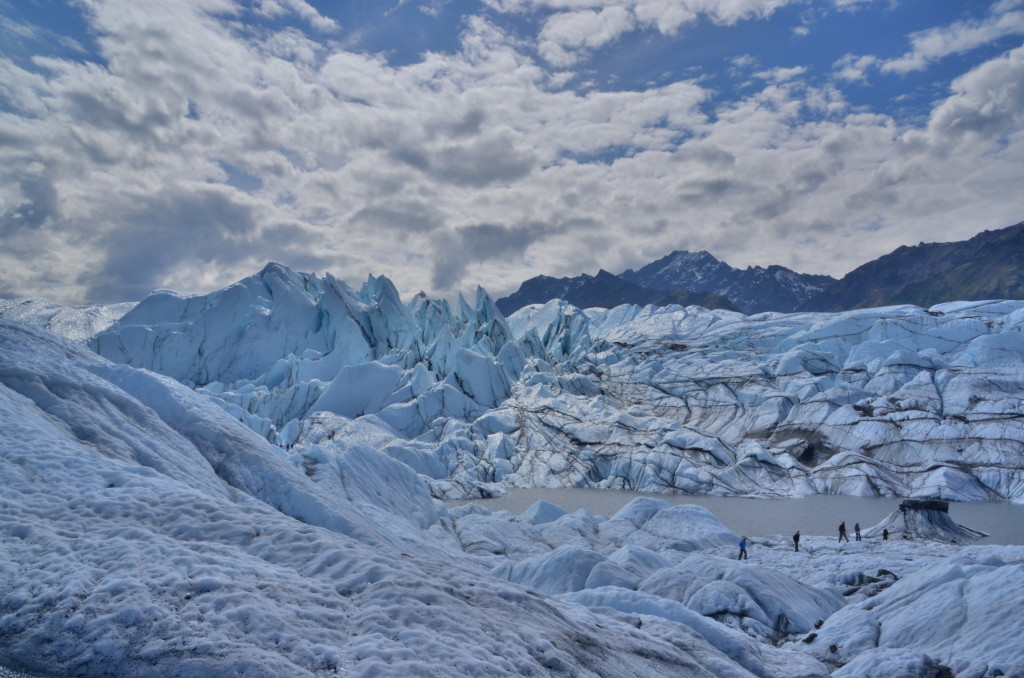
This is the easiest way to hike on a glacier. Drive down Hwy 1 and look for the signs. About 50 miles east of Palmer. It costs $20 ish per person. You sign a waiver and you can hike on the glacier. Bring crampons or microspikes. Once you get on to the glacier it’s another world. Be careful of your footing and don’t venture too far without proper equipment like ice axes and crampons. You can always get a guide.
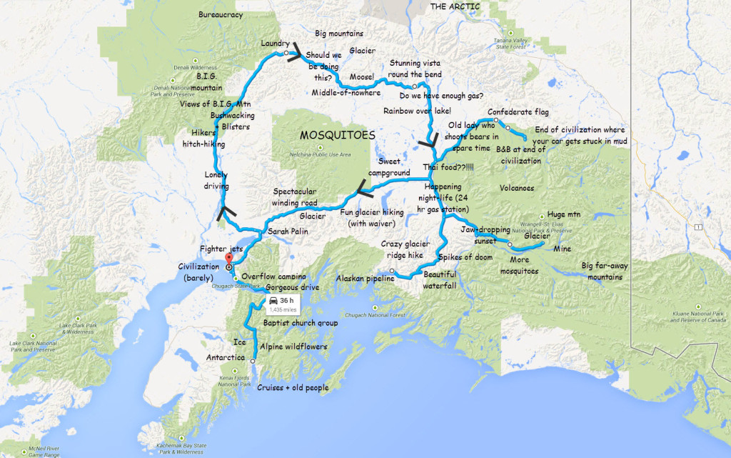
Finally, here’s a summary of Alaska from my perspective.
Other Hikes / Vistas
I’ve only covered road-accessible hikes. This means I’ve covered only a small part of Alaska. If you have the money to hire guides and planes, all of Alaska opens up to you. Below are some other road-accessible hikes worth mentioning, but not as good as the hikes above.
Byron Glacier: An easy drive from Anchorage, this short trail leads to the mouth of the glacier. It’s a great trail because it provides very easy access to the glacier. If you have gear, you can easily start hiking up the glacier.
Denali National Park: If you have lots of time, you can go to the Backcountry Permit office and figure out a backpacking trail in the park. Bear in the mind that there are no trails, the bus ride in and out takes a while, and there is red tape. For the time-strapped, I highly recommend Kesugi ridge instead.
Denali Highway: This is a beautiful, well graded and level dirt road between Cantwell and ending on Hwy 4. Don’t be misled by the words “dirt road”. We averaged a good 45 mph on most of it, riding roughshod over any ruts on our Kia Optima. Ha. Of course, your mileage may vary. ;-) The road is the second highest in Alaska at the MacLaren summit. Instead of going up to Fairbanks, we took this road across to get to Wrangell-St. Elias.
Nabesna road: This is the other road into Wrangell-St. Elias national park, the first being the McCarthy road. In summer, there are a few dodgy stream crossings when you get further in. The road ends in Nabesna, pop. 5, with a B&B, an airstrip, and not much else. The trail to do here seems to be the Skookum volcano trail but we didn’t have the time. The NPS also opened a new campground along the Nabesna road, which is neat. The name I forget. There is a park office at the road’s start. And don’t miss the Confederate flag flying across the park office. The locals dislike the NPS and dislike the park’s protected status, as the giant board on the side of the road states. Bonus: There is a convenience store around where the road meets the main highway. In the store is the quintessential old lady of the fables who will tell you tales of shooting bears in her backyard. Don’t miss her!! Oh, and if you ignore the “Road Closed” sign and go too far down Nabesna road, your car will get stuck in mud and you will have the most stressful 30 minutes of your life as you get it out of mud, hours from any tow trucks and help. Trust me.
Jumbo Mine hike: This is the alternative to the Bonanza Mine hike. From what I understand, it’s quite similar.
Root Glacier: Once you’re in Kenecott, it’s very easy to access Root glacier. Root glacier can even be traversed by the intrepid or with a guide service.
Eklutna Lake: A short drive from Anchorage to the lake. Nothing fancy here though.
Near Anchorage: Flat-top mountain is popular. Here’s a good summary of some other close hikes.
Acknowledgements: This post goes to Evan and Jesus, without whom this trip would never have been possible. They are the best hiking buddies one could hope for.